For my lab this week I chose to pinpoint some of the different stadiums in the National League Western Conference. Since baseball has been going into the playoffs and the Dodgers have been making a good run, I wanted to take a look at the different teams in our conference and plan out a trip in the region. The different teams include the San Francisco Giants, Colorado Rockies, Arizona Diamondbacks, and San Diego Padres. I chose to do this type of Neogeography because I would like to one day take a trip with some friends in this manner. I noticed some things that were a bit unexpected to me during the project and they include many different locations on the way I never considered, a better estimation of distance, and overall geography of the land in terms of terrain.
Creating my own map for this assignment brought some confusion in trying to place everything correctly. There are soo many sources on the internet that share related interests or links, that it makes it difficult to locate specific things. I guess the best part is knowing what you really want to work with because it will allow you to search to the precise location desired. In addition, something convenient is being able to locate other points of interest along the way with my trip. I noticed pictures of several historical landmarks, things I did not know about, and things I wish I could now take a look see. One of the possible pitfalls is relying too much on this information for planning. Since it is neogeography, it is still very possible to make mistakes. People that post these up, like myself, are not professionals that I know about. The potential of the map can be exponential. Now that I have laid out the general route to get where I want to go, I can possibly add a video and stream footage along the way while on the road trip. That would be a cool feature that is possible to upload on things like this googlemap.
http://maps.google.com/maps?tab=ml
http://maps.google.com/maps/ms?gl=us&hl=en&ie=UTF8&msa=0&msid=117095613319668832451.00047610b1c0d2cce0c89&lci=com.panoramio.all&ll=40.111689,-104.853516&spn=47.895688,79.013672&z=4
Friday, October 23, 2009
Thursday, October 15, 2009
Lab#2: USGS Topographic Maps
1: The name of the quadrangle is "Beverly Hills."
2: The names of the adjacent quadrangles are: Topanga and Hollywood
3: The quadrangle was first created in 1966
4: The National Geodetic Vertical Datum of 1929 was used to create the map
5: The scale of the map is 1:24 000
6:
a) 5cm on the map =1200m on the ground.
b) 5in on the map= 1.89mi on the ground.
c) 1mi on the ground= 2.64in on the map.
d) 3km on the ground= 12.5cm on the map
7: The countour interval of the map is 10ft .
8: geographic coordinates in Degrees/Minutes/Seconds & Decimal Degrees for the following:
a) The Public Affairs Building: 34/04/14N & 18/26/40W
b) The Santa Monica Pier: 34/00/31N & 118/30/53W
c) The Upper Franklin Canyon Reservoir: 34/7/12N & 118/24/36W
9: Approximate Elevation in meters & feet of:
a) Greystone Mansion: 550ft; 165m
b) Woodlawn Cemetery: 140ft; 43m
c) Crestwood Hills Park: 800ft; 244m
10: The UTM zone of the map is 11.
11: The UTM cordinates of the lower left corner in the map is 376300 Northing and 362000 Easting
12: There are 1,000,000 square meters within each cell of the UTM gridlines.
13: East to West Elevation Measurements along the UTM Northing 3771000

14: The magnetic declination of the map is 14 degrees.
15: The intermittent stream between the 4050 FWY and Stone Canyon Reservoir flows Southbound.
16: 
Lab#1: 3Maps
 This is the most intricate map I have seen. It is the Tokyo Subway Route Map. I was able to retrieve the map from speedymole.com which is a website providing layouts of subway systems around the world. I have never been to Tokyo but I would like to visit that region of the World at some point in my life. Hopefully sooner than later. With such a dense population however, they are largely dependant on the subway. This also affects the cultural interaction of their society. In places like LA people like to drive because the highways allow for it. With such a large city, I can only imagine what the transportation is like.
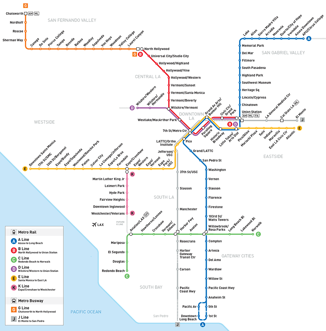 This is the Metro Subway System Map for the city of Los Angeles. I was able to get the image from the Metro Website which I use often: metro.net. I grew up in the East Side of Los Angeles where we do not really have rails. The main mode of transportation in the LA area is by bus. Since the city has an abundance of freeway, it is much easier for buses to take the highway than install railways throughout the city. Looking at the map there are 5 subway rail lines that run throughout the larger LA area. Expansion on the map also shows the expansion of the Gold Line which is most pertinent to me living East of Los Angeles. Commuting in LA for me has been difficult without a car. While I do not like the bus per say, the subway system does not provide a better alternative because it is too limited in acccesibility.
 This map here illustrates the different subway lines in the London Subway System. In comparison to the Los Angeles subway system, this is vastly superior. London is largely dependant on their subway system and rightfully so. The lines are efficient and precise. I remember several years ago while studying abroad, I had to quickly become familiar with the system in London. Coming from Los Angeles where we are not heavily dependent on subways for mass transit, I quickly got lost. My sense of direction was completely tuned off. Since the subway is subterraneous, I could not even begin to conceive my sense of direction. My placement was off and subsequently I lacked direction. The Rail system in London can basically get you anywhere in the city over and under the rivers too. I liked that very much, in addition to the everplaying motto "please mind the rail".


Subscribe to:
Comments (Atom)